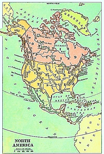
Three great oceans wash the shores of North America. Name them. The coast line is very irregular. Notice on the map that at places part of the ocean extends far into the land, forming gulfs and bays. Hudson Bay, Gulf of Mexico, and Gulf of St. Lawrence are all parts of which ocean? The waves are not so high in the bays and gulfs as in the open ocean. The land keeps off some of the wind. Vessels that are waiting to be laden with cargo lie in these sheltered gulfs and bays. Why?
At many places along the shore the land juts out into the ocean in capes. Many of these points of land have special names. Look on the map for them (e.g. C. Cod and C. Hatteras). There are light houses built on most of these capes to warn the ships in the dark and in the storms to keep away from the dangerous rocks and shore. A cape is often a pleasant place for a summer home. There is so much water around it that the sea breezes sweep across it and make it delightfully cool.
Do you remember how we spoke of the river with its many boats?
There are hundreds of rivers in North America flowing for miles until at last they reach the ocean.
Zoom in on the map of North America, and trace the rivers with your fingers.
Notebook Work: Label the top of your notebook page with "LESSON 38." Draw North America and color the oceans that surround it blue. Label each ocean with its name. Label the drawing, "NORTH AMERICAN OCEANS."
 Where We Live: A Home Geography Part II
A Home Geography II
Where We Live: A Home Geography Part II
A Home Geography II


 About
About Curriculum
 Navigation